When I arrived at NOLS Alaska for my 2011 Brooks Range Backpacking and River course, I learned that the Denali expedition, a trip for NOLS alumni, had just returned from a successful ascent. It was easy to distinguish its members from all the other students, since they hadn’t had the chance to shower yet!
That memory stayed with me not just because of the smell, but also because I was fascinated with Denali ever since I first saw the mountain during a visit to Denali National Park in 2004.
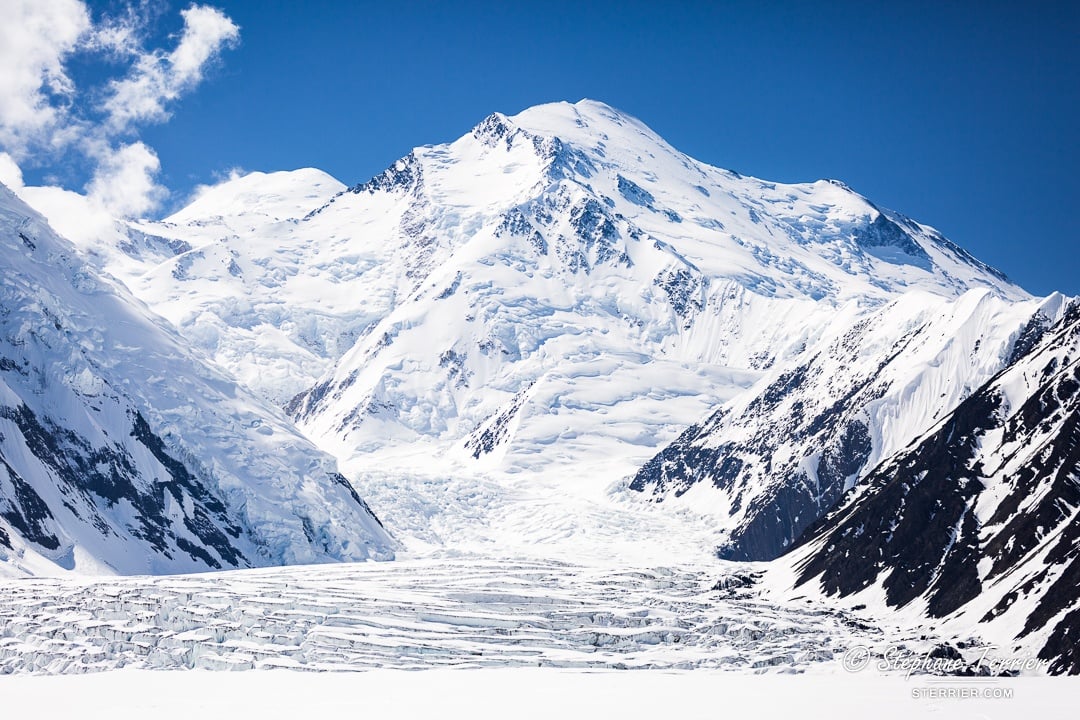
Covered with white glaciers, Denali towers incredibly high above all the other Alaska Range peaks and the surrounding green tundra. With its summit at 6,190 m/20,310 feet, it's the highest mountain of North America and one of the coldest mountains on Earth, notorious for its storms. I was instantly impressed by it.
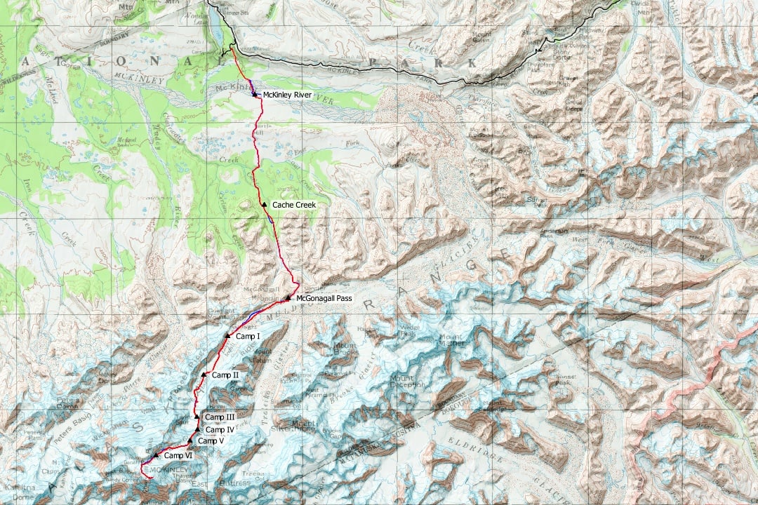
When I learned that NOLS uses the Muldrow Glacier route to climb Denali, I knew that was the way I wanted to ascend Denali. The Muldrow Glacier was the route used for the first ascent in 1913. Today, only 2% of the climbers follow the Muldrow Glacier route, mainly because it starts at 600 m/2,000 feet next to the famous Wonder Lake, making the approach much longer than most climbers are willing to undertake. For me, fewer people on the route meant more adventure.
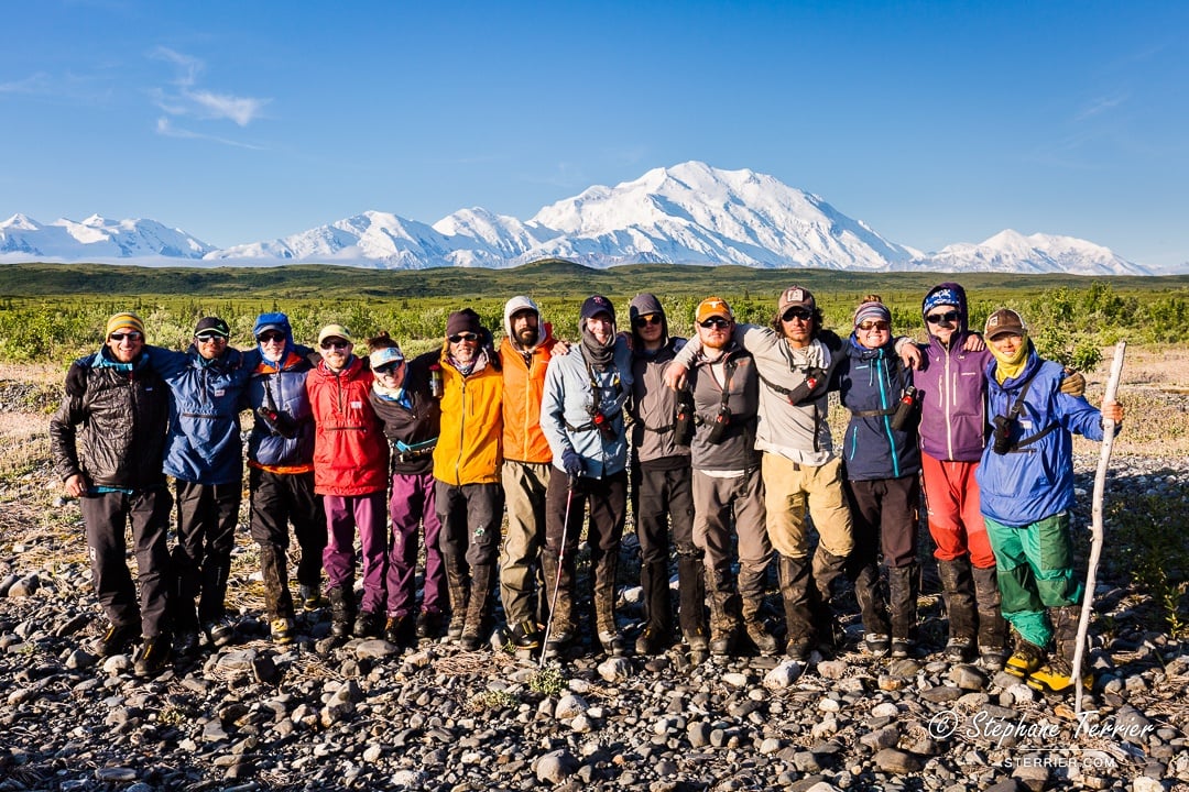
In June of 2017, after six years of dreaming, I was finally able to come back for Denali. Following two days of preparation, park registration and park presentations, we were dropped by a park bus next to Wonder Lake.
Our expedition was the only one on the Muldrow Glacier route this season: these are some of the photos I took during our 28 incredible days on the mountain.
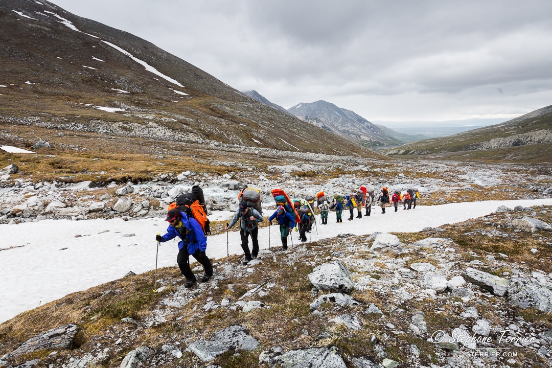
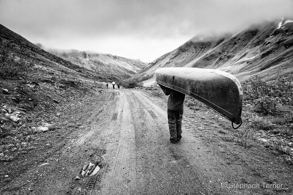
We started with a 32 km/20 mile hike to McGonagall Pass. It took us three days, with our backpacks weighing more than 30 kg/65 lbs. We were carrying all our personal and camping equipment, some food for the first five days, and most of the technical equipment (ropes, ice axes, crampons, snowshoes, sleds). On the third day, we reached alpine terrain and progressively traded the mosquitoes for snow and a drizzle as we gained elevation.
Almost all of our food and fuel was brought to Denali National Park in September 2016, and dropped by sled dogs at McGonagall Pass in the spring of 2017. When we found this cache, we gained 24 days’ worth of food and fuel in addition to our already heavy equipment. To move up the mountain, we split our load in two, and carried half during two separate days.
After two and a half days of light rain and snow around McGonagall Pass, the clouds began to clear as we started our second ferry to Camp I. We could finally start drying our boots after getting them wet on the first day crossing the McKinley River. And we were really excited to see Denali for the first time since we started at Wonder Lake. The clear weather also revealed our route and its obstacles on the Muldrow Glacier: at the bottom is the Lower Icefall, and just above is the Greater Icefall. The route then continues to the left on Karstens Ridge (hidden in this photo).
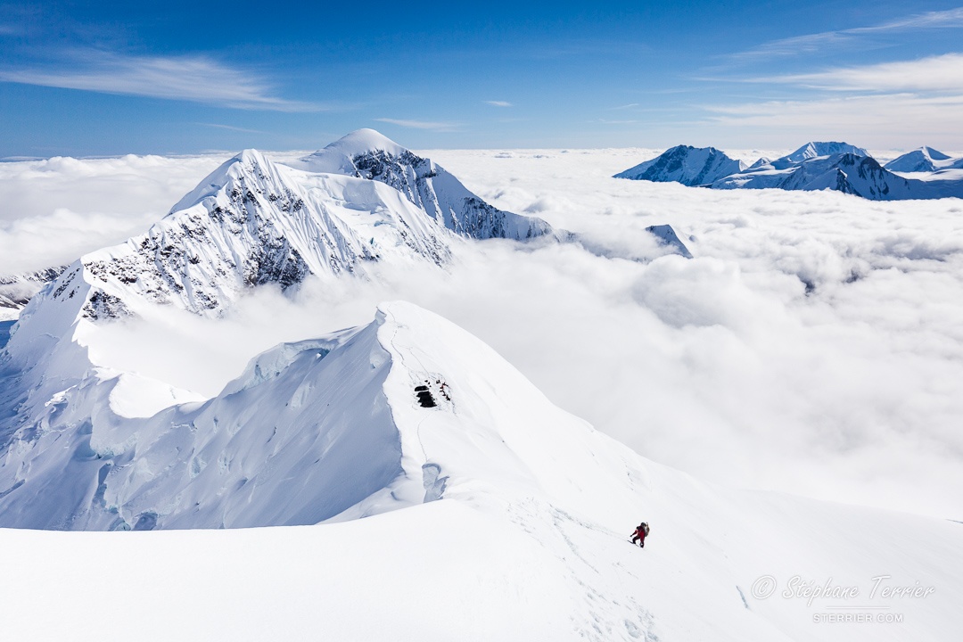
In this photo, the peak in the middle is Denali’s North Summit (5,934 m/19,470 feet), while the apparently lower peak slightly behind on the left is the higher South Summit (6,190 m/20,310 feet). The 1910 expedition actually summited the North Summit thinking it was the highest of the two, and discovered on top that they were wrong.
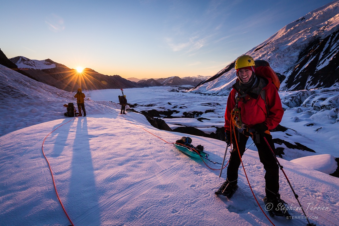
To ascend the Lower Icefall, we passed on its left side (facing downstream), just under Pioneer Ridge. To mitigate the risks of the steep snow/rock couloirs and hanging glaciers above this section, we traveled at "night"—meaning we woke up at midnight just in time for sunset, got moving, and saw the sunrise a few hours later. Being in the Land of the Midnight Sun, it was never dark during the whole expedition.
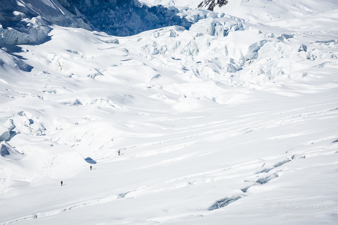
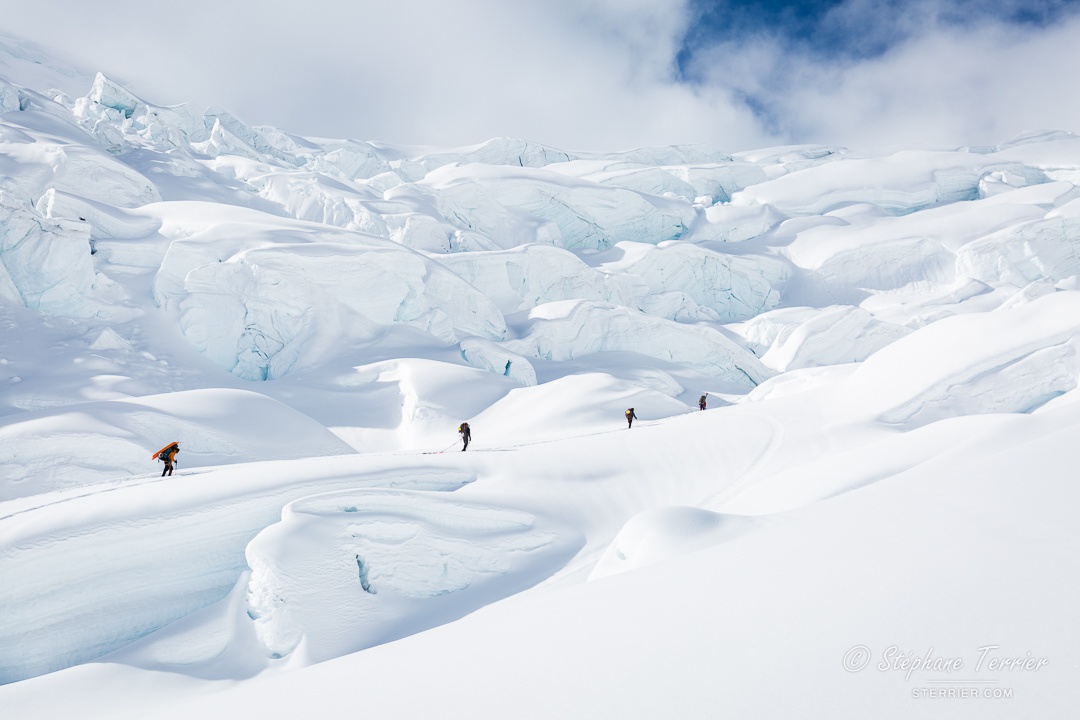
On Denali, and generally in Alaska, it's hard to grasp the size of natural features. The only scale reference we had were ourselves or the small aircrafts circling around the mountain. Here, the first rope team is looking for a way in the crevasses of the Hill of Cracks, and shows how long the crevasses are.
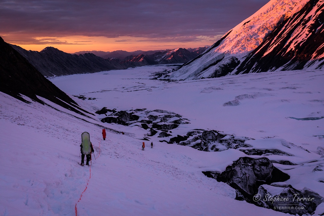
Returning from Camp II to Camp I to get the other half of the load offered us a second "night" with spectacular colors in the Lower Icefall. McGonagall Pass appears in the background between the two groups of sunlit faces.
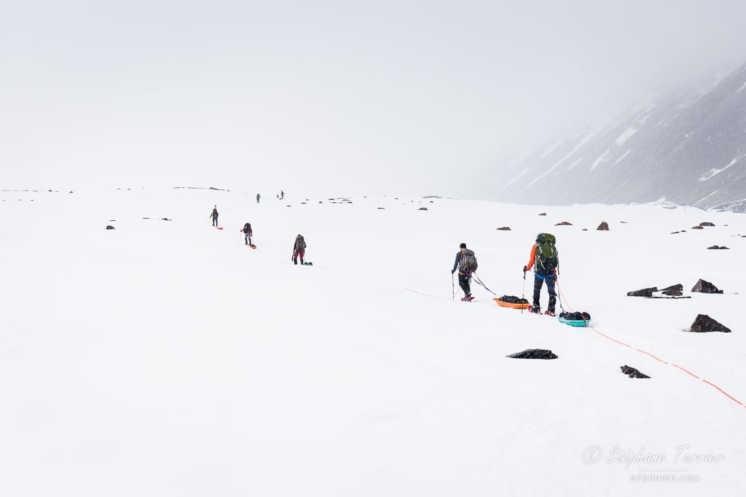
To move from Camp II to Camp III, we had to pass the Great Icefall, which comprises large crevasses and piles of seracs—towers of ice on the glacier. Our first day to cache food and fuel above the Great Icefall started with cloudy weather and decent visibility that quickly devolved into a whiteout, making the routefinding much harder. To retrace our steps back to the safety of our tents in Camp II, we regularly placed bamboo wands until we ran out of them, then turned around. On our way down, our track had almost completely disappeared under more than 30 centimeters of fresh snow that fell within a few hours. When we arrived back at Camp II, we discovered that the tents had partially collapsed under the weight of the wet snow, breaking and bending tent poles.
The next day, we were lucky to have sunny weather for our second slalom in the Great Icefall. We admired the giant crevasses and seracs that we passed in the whiteout the previous day. Surprisingly, we only made a few detours around crevasses in the fog, and we were heading in the right direction when we ran out of wands. After setting up Camp III, we had to get the cache from the previous day that we’d left 1.5 km down from camp. It meant that we had to climb, for a second time, a hill that we nicknamed Heartbreak Hill…Nobody was disappointed it was the last time we used sleds after that!
Camp III was in the giant cirque of the upper Muldrow Glacier. It wasn't particularly high, but there was a chilly wind coming down from high glaciers and the sun was hidden by Mount Koven. Some of our huge down jackets appeared for the first time while we were preparing breakfast and melting water for the day. Once again, everything is larger than it looks. We saw a lot of serac falls in this area, and while they looked small compared to the surroundings, the deep sound of them falling hinted at their scale. Karstens Ridge, where we headed later that day, runs from the left of the photo to the center, ending at Browne Tower (just under the cloud).

Karstens Ridge is undoubtedly the most spectacular part of Denali’s Muldrow Glacier route. After a day of slow progress in the fog to cache some food and fuel, our second day on the ridge was breathtaking. We established Camp IV on the plateau on the left side of the photo. In total from Camp III to Camp V, we climbed around 1,000 m/3,000 feet of elevation on the ridge.
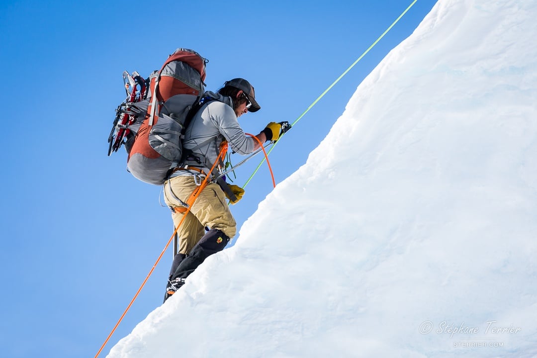
To climb Karstens Ridge safely with our heavy backpacks, we set multiple snow pickets and ice screws to clip in the rope as we progressed up or down the ridge. For one steep and icy south-facing section just above Camp IV, we installed a fixed rope and used ascenders.
It's not always easy to get out of a warm sleeping bag and tent in cold weather, but the views make it worthwhile! This was the morning view from Camp IV on Karstens Ridge. The sea of clouds of the previous days cleared to reveal the infinite Alaska Range.
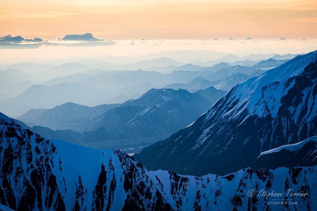
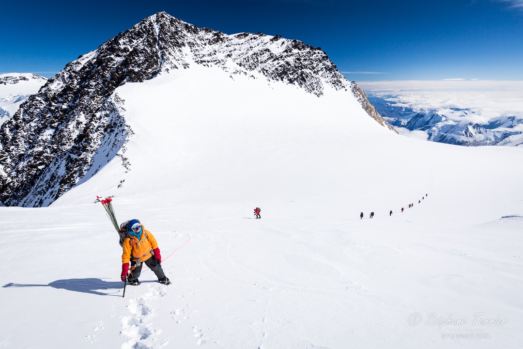
The next day was incredible in a series of incredible days. In this photo, the second rope team is reaching the upper end of the fixed rope, while the third and fourth rope teams are still waiting at Camp IV. The two peaks in the background are Mount Koven (3,701 m/12,141 feet) and Mount Carpe (3,826 m/12,552 feet). The lower half of Karstens Ridge under Camp IV had a gentle grade except for a few short, steep sections, but as we climbed the upper half stayed consistently steep. While we already seem higher than most surrounding mountains, more than 2,600 m/8,500 feet of elevation were remaining…that’s how high Denali is!
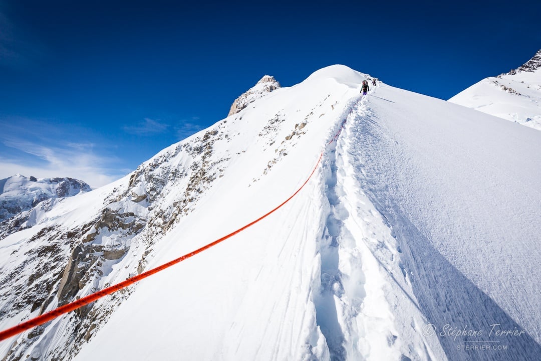
Parts of Karstens Ridge were knife-thin, with a steep drop to the Muldrow Glacier on the west, and an even higher drop to the Traleika Glacier on the east. We had to make a track right on top of the ridge, which was challenging because it was so steep and had a lot of fresh snow.
From Camp V at the foot of Browne Tower, the route continues on the Harper Glacier. The transition between the two is not easy due to the bergschrund and crevasses. We were sinking deep in the snow with our crampons.
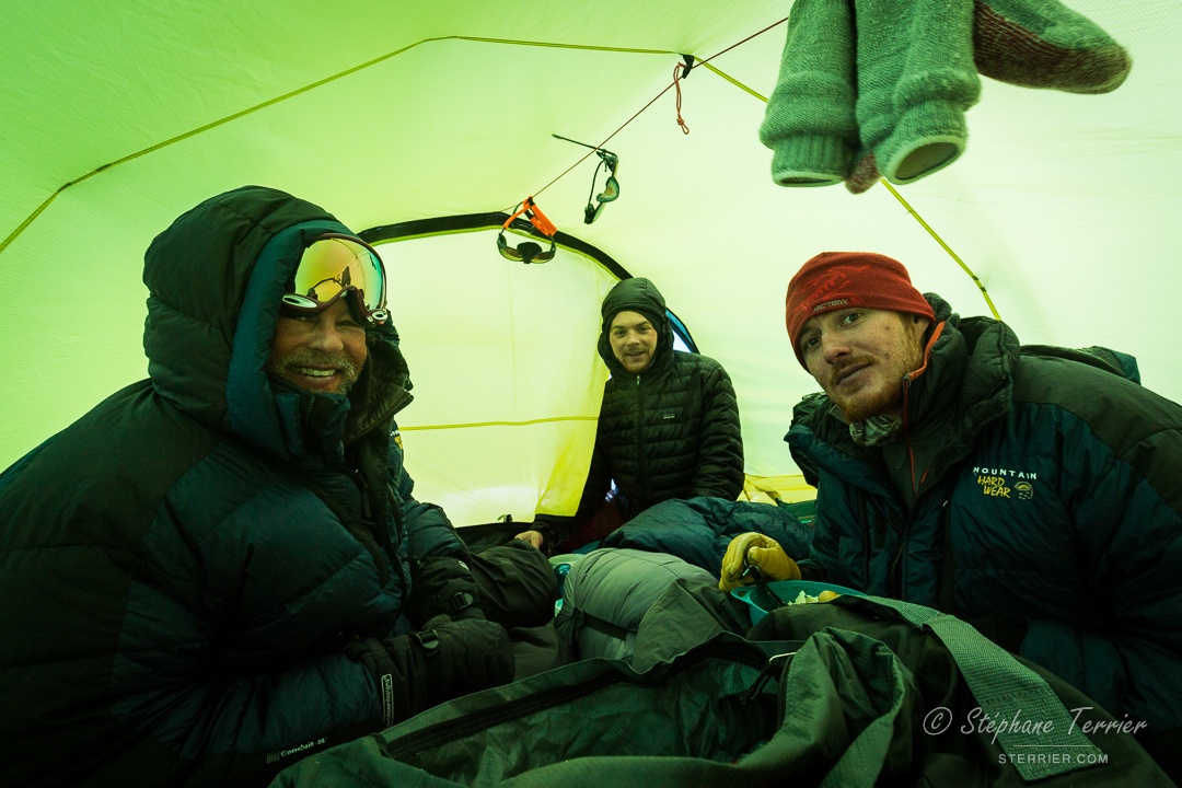
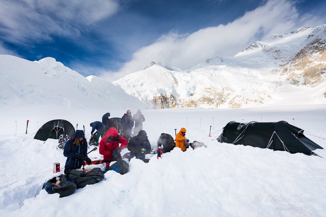
The two days on the Harper Glacier between Camp V and Camp VI were mostly sunny, but felt very different. The first was practically windless, but the second day was windy and we had to cover our skin to protect it against frostbite. To shield ourselves from the wind, we set up Camp VI at the entrance of a partially snow-filled crevasse. After hours of shoveling a platform in hard snow, we were happy to escape the elements in our tent and eat a high-altitude dinner (a soup, served with Pringles and Pop-Tart crumbs!).
After our first night at Camp VI, we rested during the day and planned on leaving for the summit in the evening—the conditions were perfect. But as we were getting ready and roping up, the weather suddenly deteriorated and we went to bed instead. The conditions were great again the next morning and we prepared ourselves to head to the summit.
Following years of waiting and 20 days of hard effort, it was a moving moment to take that day’s first steps. No matter how much you prepare, there is always massive uncertainty about the conditions you will encounter during the expedition. In the photo we are next to Denali Pass, with the North Summit in the background. The West Buttress route reaches Denali Pass from the left.
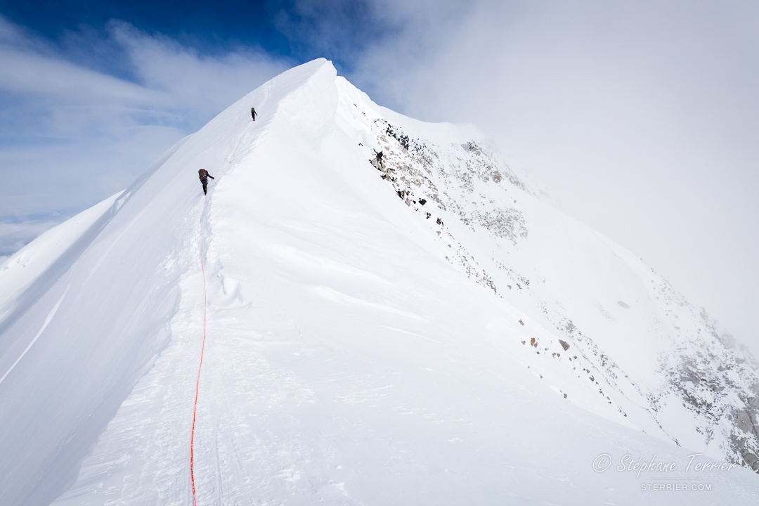
From Denali Pass, the route follows a fairly wide ridge to the Football Field, a surprisingly flat area for this elevation. It then gets on the final exposed ridge until the summit. As we were ascending, clouds were progressively building up around the summit.
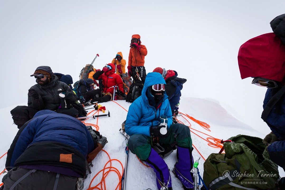
After about 9 hours of effort, we reached the summit of Denali. It was a major team success and we all summited together! Knowing that the 2017 season had a low success rate, with only 41% of climbers reaching the peak, made it even more special. After some celebration and rehydration, we had to focus again, as we were only halfway. The developing storm and whiteout made our return to Camp VI difficult, and reminded us that many things could still happen while descending to Wonder Lake.
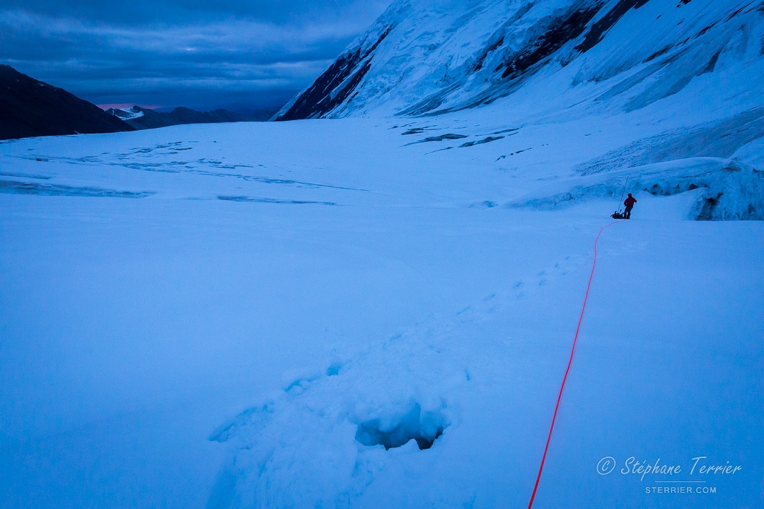
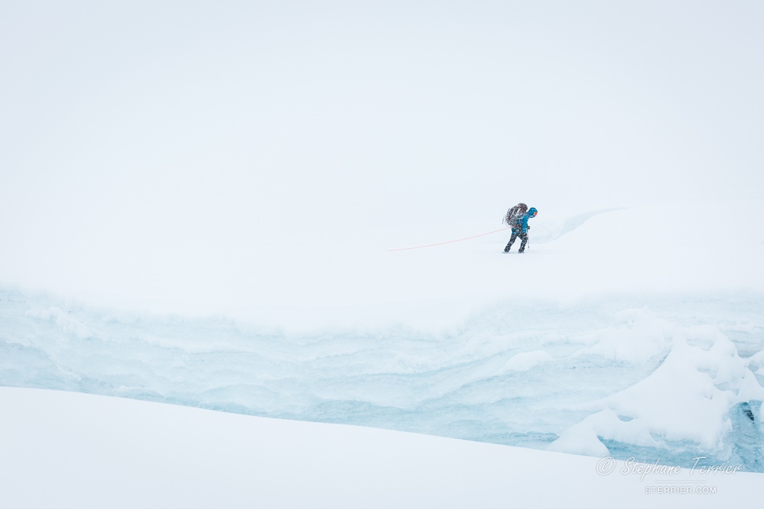
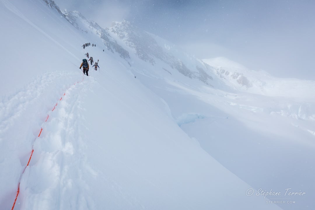
A few days later, we witnessed obvious changes on the Muldrow Glacier. Our track had often disappeared and crevasses were more apparent due to snow melt. We again traveled at “night” hoping for safer conditions, but the rotten snow’s surface hardly froze. We often postholed while making the track with our snowshoes. From time to time, the hole felt larger or deeper because it uncovered a small crevasse, reminding us that we could disappear in larger crevasses if we weren’t careful.
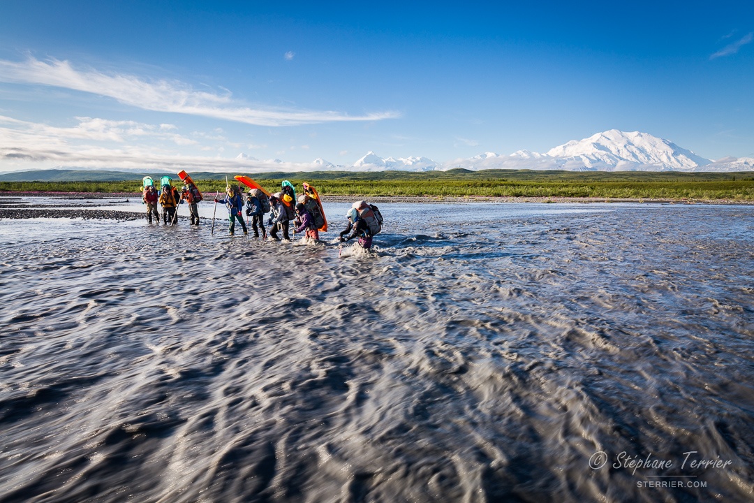
One of the biggest hazards of the expedition awaited us on the last day: the McKinley River. It was the same river we’d crossed nearly a month before, but now it was a much larger river because of the melting snow and ice in early July. After hours of scouting, we finally found a safe place to cross the mile-wide river.
One more hour of hiking led us to the park road where we waited for the bus that brought us back to civilization, food, and a well-deserved shower. Back at NOLS Alaska, we started to realize what we just accomplished while remembering all the stories and sharing them with the staff, from the sunsets to making our way back to camp in a whiteout and dealing with collapsed tents. We returned to our lives with boosted confidence knowing how far we pushed ourselves in the past month.
Go mountaineering in Alaska with NOLS
All photos taken by Stéphane Terrier