Jim Margolis and I did a week-long expedition in the Wind River mountain range to summit Mount Hooker via The Optimist, a challenging 1,600-foot route. Though we could not complete this objective due to weather, we were able to make substantial pushes up both this route, Cache Pirates, and partially develop a new route up the smaller peak that makes the west side of Hailey Pass.
The team finished packing and logistics for the expedition on July 27, hiking 15 miles into a base camp near Baptiste Lake in the Mount Hooker Cirque on July 28.
 tim packing at first light on the first attempt of The Optimist, Mount Hooker in the background. Photo: Jim Margolis
Due to the long hike the day before, it was decided to use July 29 as a scouting day for The Optimist rather than an attempt to climb the entire route. Jim and I climbed up to the first crux, pitch 6. After working the beginning slab crux, we headed down.
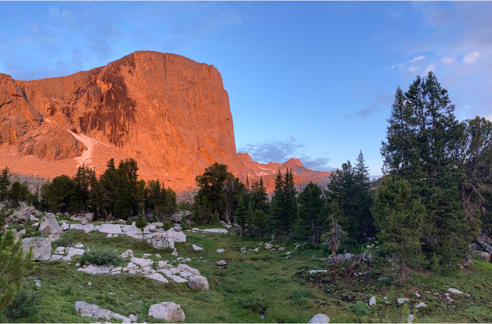
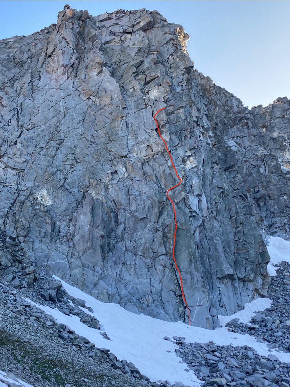
The northeast face of Mount Hooker. Both routes attempted, The Optimist and Cache Pirates, go up the left side of the steep face, right of the black streaks. Photo: tim parker
Though the climbing was overall really good, pitch 3 felt dangerous due to climbing on loose flakes. Because of this, we decided we would not repeat the first pitches of The Optimist. Instead, we planned to take Cache Pirates until it intersects with The Optimist at the top of pitch 4, and from there, continue up The Optimist.
On July 30, Jesse Quillian provided a horse-supported re-ration northwest of Mae’s Lake (just south of Hailey Pass) to provide food and gear to supply the team until August 5. On the hike to meet Jesse, we scouted some potential new routes up the smaller peak just west of Hailey Pass. The potential route pieced together some quality-looking crack systems and would be a good objective on a day with less perfect weather, as it is both shorter and quicker to rappel than Mount Hooker.
 Looking northwest from the top of Hailey Pass. The potential new route goes up the steep right side of the prominent peak on the left.
A weather report was obtained via the InReach, pointing towards afternoon build-up and lightning the next day, a potentially clearer day on August 1, and a large system moving in on August 2. Due to potential lightning, we decided to scout the first five pitches of Cache Pirates on July 31 (the top of pitch 5 of Cache Pirates shares a belay with the top of pitch 4 of The Optimist), with the hope that there might be a weather window to continue up The Optimist to the top of Mount Hooker on the August 1. The team found the climbing on this route excellent and safe.
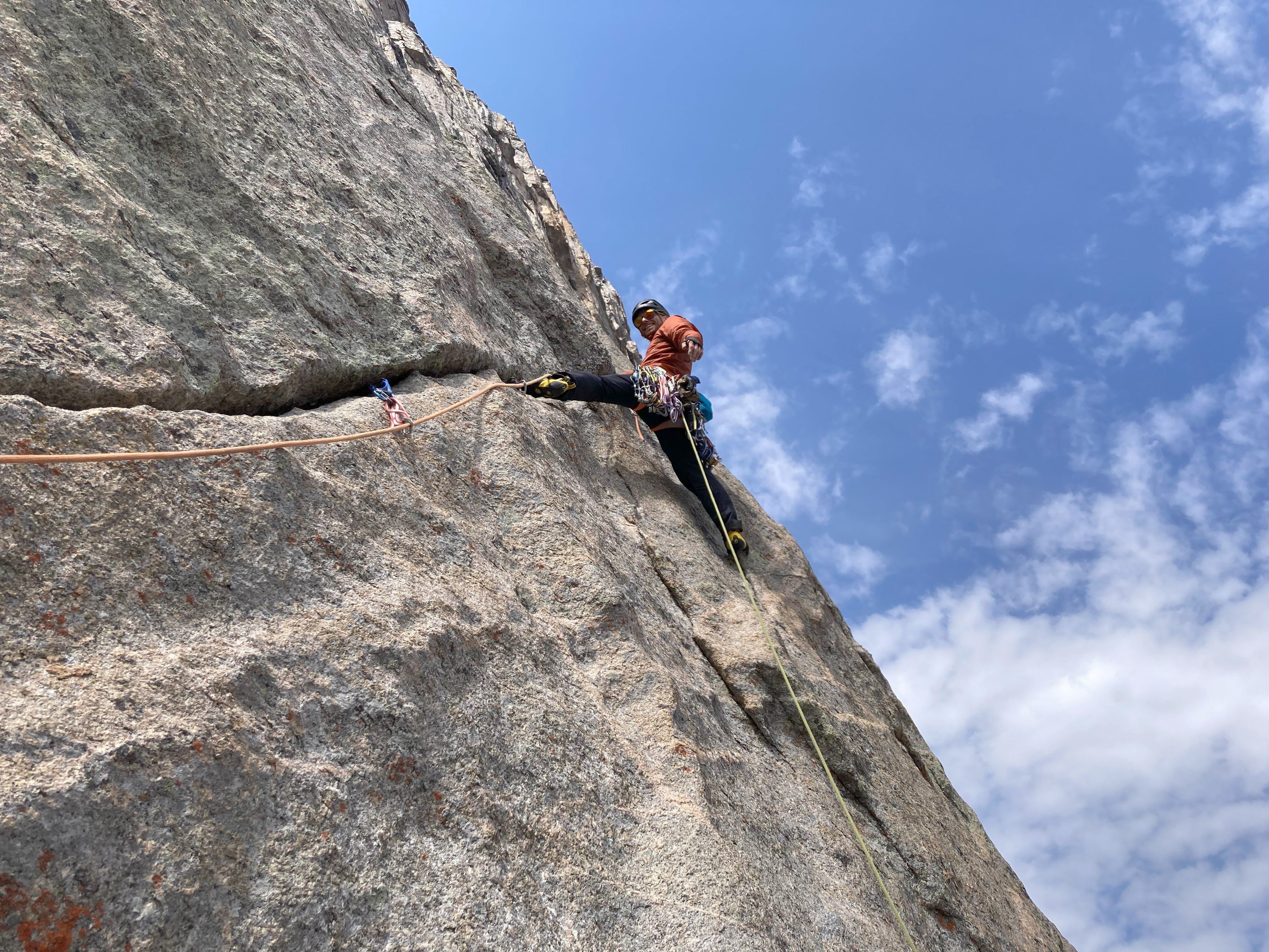
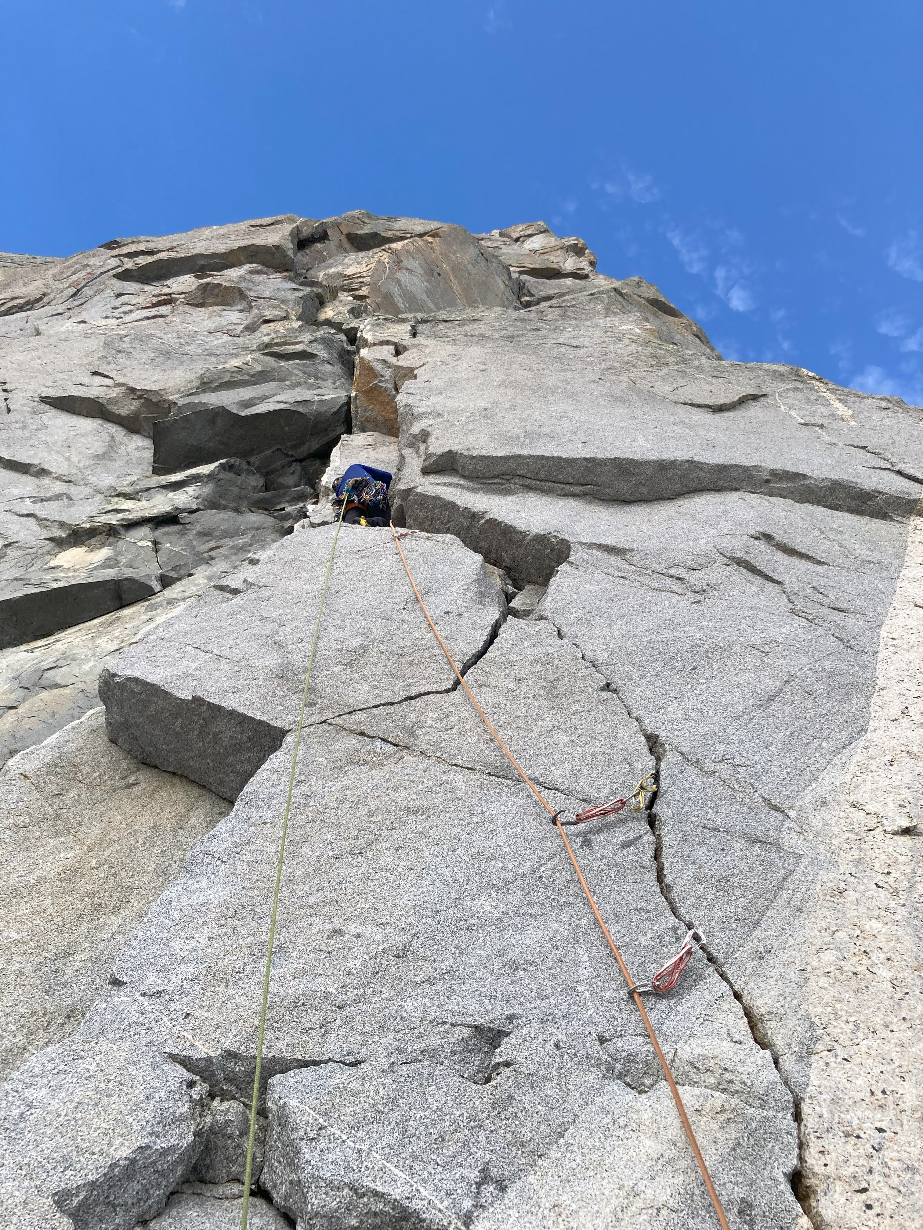
Tim enjoys the long angling crack on the fifth pitch of Cache Pirates. Photo: Jim Margolis
Thunderstorms were forecast to move in at 2:00 pm, so we chose a turnaround time of noon (assuming observations didn’t indicate a need to bail sooner). Jim and I reached the top of pitch five around 11:30 am. Though the buildup seemed to be clearing up, a conservative decision was made to stick to the turnaround time, and we descended. Though the thunderstorms never materialized, this felt like the safer decision.
On the morning of August 1, the weather was checked again. Thunderstorms were forecast to come in around 4:00 pm. Due to the length and committing nature of the routes on Mount Hooker, a full day of good weather is needed to summit. Because of this, a shorter and less committed objective made more sense. Instead of Mount Hooker, we decided to scout the exploratory line we saw on our re-ration day. We estimated the route to be about 600 feet of challenging climbing and a couple hundred feet of low 5th/4th class climbing to reach the summit (Instead of over 1,500 feet of sustained and challenging climbing).
Approximate route Jim and Tim scouted before being turned around due to weather. Photo: tim parker
Based on the previous day’s weather, a turnaround time of 2:00 pm was decided to give enough time to get down before the weather moved in. The new route provided surprisingly good quality climbing, relatively sustained at the grades.

 Pitches 1, 2, and 4 respectively. Fun climbing! Photos: Pitch 1: Jim Margolis; Pitch 2 and 4- tim parker
A few short sections of loose or bad-quality rock had to be navigated through but, most importantly, could be avoided. There were a few signs of previous teams on the first and second pitches and a crack system to the left of their 5th pitch (some fixed stoppers and a piton). Though some sections had been climbed before, much of the route was likely new. No information on the Mountain Project or guidebooks for the area mentioned any routes on this feature.
The team reached the top of pitch four at approximately 11:30 am. There was a brief discussion on whether to descend due to clouds building quicker than forecast. We had one more pitch of challenging climbing until the low 5th class climbed to the top. Because of this and the forecast of 4:00 pm for the storm to move in, we decided to scout the next pitch and, if it seemed straightforward, continue up to the top. I climbed up about 15 meters, at which point the crack traversed around an arête into a broken and loose corner with a large roof overhead. The arête looked climbable but would need one or two bolts placed to climb it safely. The weather had worsened considerably in the 20 minutes since the decision to scout the 5th pitch, and we decided it was time to descend.
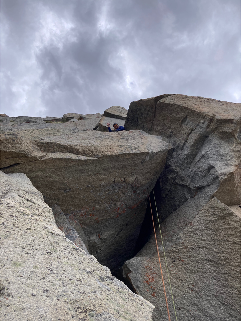
Tim on the 5th pitch, shortly before the decision to turn around. Photo: Jim Margolis
As I began to descend the pitch, I heard the first thunder. Shortly after I arrived at the belay, rain, and lightning also came. The team rapidly descended via two 70-meter rappels and returned to camp once the lightning had eased.
At camp, we checked the weather again. The storm was moving in quicker than forecast, with lightning potential by midmorning and lasting for at least the next two days. Because of this, the expedition decided to break camp and hike over Hailey Pass to Mae’s Lake that evening and then finish the hike back out to the car the following morning. This allowed us to hike exposed sections of the trail before the lightning hit. On August 2, after Jim's birthday celebration, the team hiked back to the trailhead at Big Sandy and headed back to Lander.
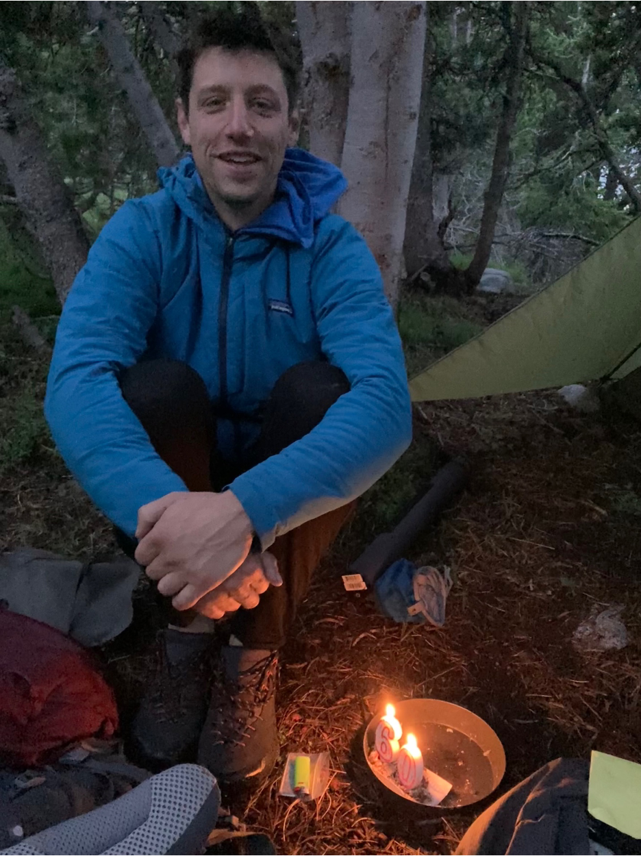
It’s not every day you get to celebrate your 60th birthday in the mountains! Happy Birthday, Jim! Photo: tim parker
Although we could not complete our planned objective, the expedition provided ample opportunity to climb in challenging terrain, spend quality time together, and plan and execute the logistics of a remote climbing trip. Further, developing a new route in the alpine of a challenging grade provided lots of learning! Beyond the continued learning of team dynamics, decision-making, and multi-pitch systems that climbing always provides, the fickle weather provided a great opportunity to learn more conservative decision-making regarding afternoon build-up.
The subjective hazard of having an earlier forecast of thunderstorms the day before that never materialized lulled the team into thinking the same thing would happen the next day, or at least not materialize early. Instead of not happening, the storm came in four hours early. In retrospect, had we not been using a weather forecast and only been going by observations, we would have decided to descend much earlier based on the buildup. Though we purposely chose a more conservative objective (in difficulty and length) because of the weather, exploring a new route caused us to move more slowly than anticipated (route finding, cleaning the route, and greater difficulty than expected). This made the objective effectively more ambitious than the day warranted.
Our highlights included: climbing the bottom third of Mount Hooker twice, incredible sunrises, going for dips in the lake, Jim’s birthday celebration, and scouting a new potential route. Overall, it was a wonderful trip, and the team is very thankful to the NOLS Rothberg-Birdwhistell Exploration Fund for the opportunity!
The Rothberg-Birdwhistell Expedition Fund was established by the Rothberg-Birdwhistell family to support NOLS Instructors as they design and execute personal wilderness expeditions.